
Ecological Adventures
Fort Assiniboine Sandhills Wildland Provincial Park
The spectacular Fort Assiniboine Sandhills Wildland Provincial Park is located along the north shore of the Athabasca River. This large natural area has many trails for horses and hikers, including a section of the original Klondike Trail. Immediately to the north of the park there is a section of crown land that is available for motorized vehicles. You can access the park via the historic Klondike Ferry.
The park contains two distinct environments: upland dunes and riparian forests. The upland dunes include jack pine lichen forests with numerous intervening fens. The fens represent a diversity of types including open water, sedge fens in various stages of succession, and fens dominated by larch.
Riparian communities consist of a series of meander scars with a variety of forest types including white spruce, balsam poplar and aspen poplar in various mixtures. Intervening oxbows vary from open water through bog birch-Labrador tea communities, to those dominated by black spruce and larch in either pure or mixed stands.
Forests harbour species such as pileated woodpeckers, various wood warblers and flying squirrels that favour old growth. Sandhill cranes nest in the fens. More than 435 plant species have been recorded in the park.
Map (Klondike Trail Staging Area)
About Woodlands County
Click on image to play video
Gardenview Sanctuary
This 100-acre site is 20 km SW of Barrhead and consists of approximately 100 acres of upland habitat next to a wetland. The uplands are reclaimed from a previous cultivation lease and are predominantly grassland with some planted shrubs and tree encroachment from scattered clumps of aspen.
The open grassland is used by upland nesting songbirds and ducks. The adjacent wetland is an important breeding and staging area for waterfowl.
About the County of Barrhead
Click on image to play video
Imrie Park
Imrie Park is a wonderful place for exploring nature. There are forests, marshes and hiking trails. The star attraction at the park is an amazing wildlife blind on the shore of Devil’s Lake where waterfowl and birds of prey can be observed. Deer are often seen in the area as well. The lake itself is popular for fishing and watersports.
There’s a campground on site with 18 camping spots, many of which back onto the forest. A cookhouse, playground, enclosed picnic shelter, and a day use area are also available on the site. Group camping is permitted (with reservations), which includes exclusive use of the cookhouse. Dogs are permitted but must be leashed.
Imrie Park is a year round attraction, featuring cross country ski trails and snowmobiling in the winter.
The park is located a short drive from Edmonton, St. Albert, Spruce Grove and Stony Plain. It’s about 8 kilomotres east of Onoway on the shores of Devil’s Lake, just off highway 37.
Imrie Park is a local treasure for day trips and longer stays. The land for the park was donated to the people of Alberta in honour of Marie Louise Imrie for conservation and public enjoyment. It was donated through the Recreation, Parks and Wildlife Foundation Park Ventures Fund.
More about Lac Ste. Anne County and Onoway
Hard Luck Canyon
Carved by Hard Luck Creek through the sandstone layers of the Paskapoo Formation, Hard Luck Canyon is a unique geological feature within Woodlands County.
Follow the hiking trail to the bridge located at the canyon’s edge for the best view. The bridge spans the falls, which are fed from a beaver pond that typically overflows in the spring. Venture down the series of stairs and paths to the canyon floor to get a closer look at Hard Luck Creek and the canyon walls.
Whether you are an avid hiker or a leisurely stroller, you will find what you are looking for at Hard Luck Canyon.
Just park your car and take to the trails. You won’t be disappointed.
The picnic areas provide the perfect spot for you to take a break from exploring and eat outdoors.
About Woodlands County
Holmes Crossing Sandhills Ecological Reserve
Located 39 km north of Barrhead, Holmes Crossing Sandhills Ecological Reserve is a nature lovers paradise. This reserve contains some of the best (and one of the few occurrences of) transverse sand dunes in Canada. The dunes are stabilized with jack pine-lichen forests.
Filled with several small lakes, this reserve offers nature lovers views of a diverse array of wildlife including, cougars, bears, deer, bobcats and much more. Intended for day use visitors, camping is located on a first-come first-serve basis just north of the reserve boundaries.
Sightseers can also enjoy elevated scenic views on the southern edges of the Athabasca River, just north of the park.
About the County of Barrhead

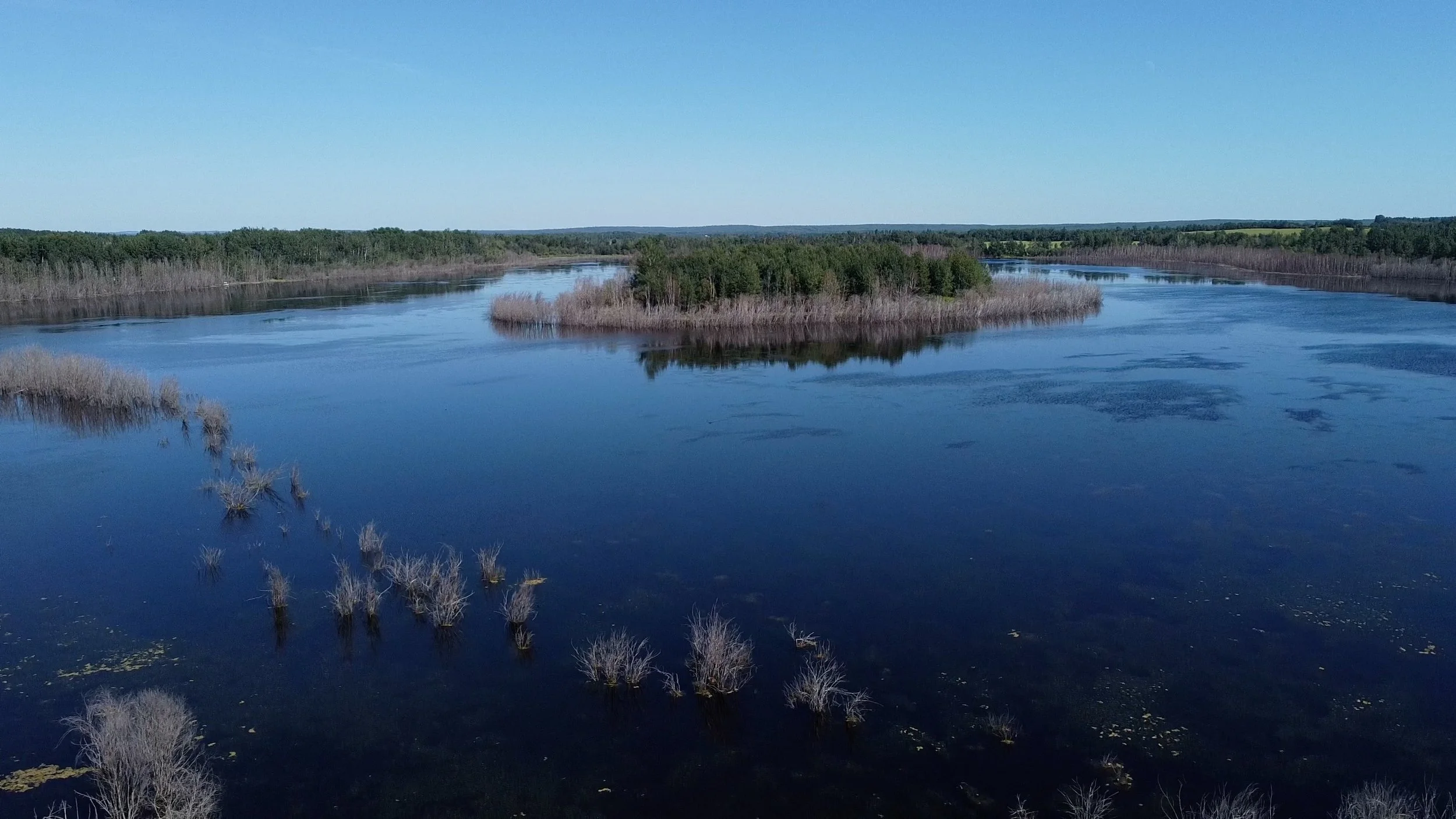
Hubert Lake Wildland Provincial Park
Hubert Lake Wildland Park consists of a sand dune complex and numerous small lakes and wetlands. Jack pine is the dominant tree species on the dunes. Itervening depressions support black spruce and larch, with open fens in wetter areas. The park is an important nesting area for great blue herons and sandhill cranes. A small caribou herd wanders in and out of the park.
Random backcountry camping is permitted. There are no developed camping facilities in the park. OHVs are permitted on designated trails only. Off-trail use is prohibited.
About Westlock County